

Way of St. James Tyrol runs along edge of Karwendel in Inn Valley over sunny Gnadenwald plateau. Pilgrimage from East to West: St. James Tyrol Stages, accommodation, places of pilgrimage.
Way of St James Tyrol
Way of St. James Tyrol: "The Way of St. James always begins where a pilgrim sets out." Nothing could describe the famous Way of St. James better than this proverb. For the Way of St. James consists of a multitude of pilgrimage routes through Europe. The destination is always the same: the Holy Sepulchre of the Apostle James in Santiago de Compostela in north-western Spain. The Tyrolean Way of St. James consists mainly of forest and cycle paths. Best walked between May and October. Tyrol was already an important section of the Way of St. James in the Middle Ages. Witnesses of this time are numerous chapels and churches dedicated to the saint. The Way of St. James Tyrol leads through the Hall - Wattens region from Gnadenwald to Thaur. Past places of spiritual significance in the region such as St. Martin in Gnadenwald, the Basilica of St. Mary in Absam or Romedikirchl high above the town of Thaur. In Innsbruck, in addition to a larger-than-life pilgrim statue at the entrance to the city, there is also the Cathedral of St. Jakob, over whose gates the saint in the pilgrim's robe watches. Away from the large crowds of pilgrims, the wonderful nature, majestic mountain peaks and themed paths along the route offer an opportunity to contemplate and linger in the moment.
Length
271,8 km through
Tyrol from Lofer to
St. Christoph/Arlberg
Stages
flexible 12 stages on
the Tyrolean section
of the route
Altitude
highest point
1852 hm
lowest point 501 hm
Meters of altitude
uphill 5589 hm
downhill 4371 hm
Difficulty
medium difficulty
(red mountain trails)
for experienced hikers
Marking
throughout
panels & labels
(not standardized)
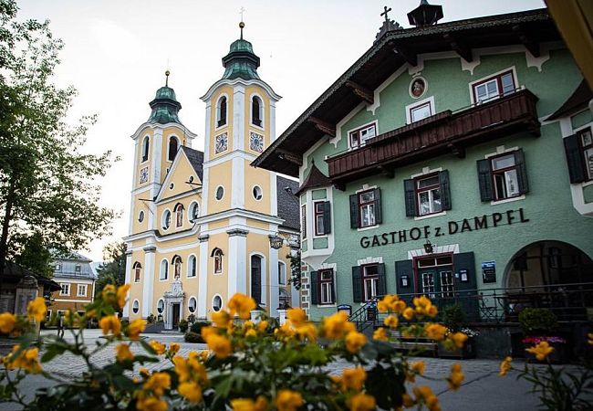
Altstadt Hall in Tirol
Route length: 17 km | duration: 5:00 h | metres in altitude uphill/downhill: 289/55 m | easy
The tour begins in the centre of Lofer. Head southwest to Loferer Street, continue along the creek Grießelbach to the Waidring open-air swimming pool. From here head south along the stream through the forest to the Pillersee. This stage ends at the southern tip of the lake in Ortisei.
Stage 2: St. Ulrich am Pillersee - St. Johann
Route length: 17.6 km | Duration: 5:00 h | Altitude difference uphill/downhill: 170/354 m | easy
From St. Ulrich walk along the western then eastern bank of the creek Grießelbach. Later shorten the bend of the stream to just before Schwendt and take the path south via Rossau. Continue via Flecken, St. Jakob in Haus, Torfmoos to Mühlbach. From here parallel to the railway line and the Fieberbrunner Ache to the centre of St. Johann.

Route length: 12.9 km | Duration: 4:00 h | Altitude difference up/downhill: 252/102 m | easy
From St. Johann along Kitzbüheler Ache, then Aschauer Ache to Rettenbach. Walk parallel to the stream. Follow Roman path, Vierstadl path and Aschauer path. Follow the latter first west, then south to Innsbrucker Street. On the south bank of the creek Goingerbach via Going to the stage destination Ellmau.
Stage 4 Ellmau - Wörgl
Route length: 25 km | Duration: 7:00 h | Metres in altitude uphill/downhill: 274/561 m | easy
Leave Ellmau west on Austraße, along Faistenbichl to Loferer Strasse south of the Weißache. Via Bärbichl to Söll. Then hike south. Shortly before Itter, take the path northwest to the Luecher creek and the Brixentaler Ache. Follow the Ache to Wörgl.

Route length: 26.6 km | duration: 7:30 h | metres in altitude uphill/downhill: 407/373 m | easy
From Wörgl west towards Thal via Egg, Berg and along the village creek to Breitenbach. Along the Inn towards Kramsach, Brandenberger Ache, then cross the Inn and in Rettenbach-Kramsach along the railway line to the Brixlegg roundabout. First cross the railway, then Alpbach. Continue in a south-westerly direction via Sankt Gertraudi to Strass im Zillertal.
Stage 6 Strass im Zillertal - Terfens
Route length: 20 km | Duration: 5:30 h | Metres in altitude uphill/downhill: 354/277 m | easy
From Strass to Rotholz, cross the Inn there, continue to Jenbach station. Along the Gießenbach stream via Tratzberg to Stans. Near A12 past Schwaz, through Vomp and to Vomperbach stream. Cross the stream and walk north of the railway line to Terfens.
Route length: 27 km | duration: 8:00 h | metres in altitude uphill/downhill: 477/494 m | easy
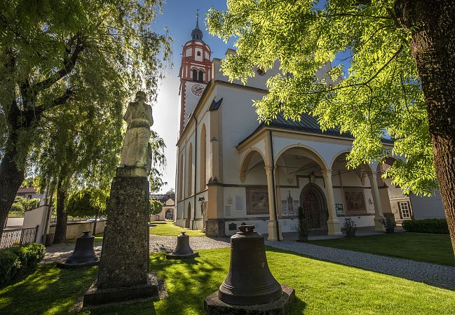
Follow fisherman's alley along the Grandlbach creek, then along the Gungglbach creek. Cross the stream, continue westwards via St. Michael at the edge of the forest to Urschenbach. Along the contemplation path to the Walder Chapel. Southwestern path out of the forest via Absam, Hall in Tyrol to Thaur. Then south via Rum, Arzl and Mühlau to Innsbruck.
Stage 8 Innsbruck - Pfaffenhofen
Route length: 34.9 km | Duration: 10:00 h | Metres in altitude uphill/downhill: 461/410 m | easy
Leave Innsbruck at the Inn and cross south of the B174. Choose river bridge near Inn Valley motorway, continue through Völs, past Kematen in Tyrol via Unterperfuss back to the Inn. Along the river bank, via Inzing, Hatting, Polling in Tyrol and Flaurling to Pfaffenhofen.
Route length: 32.7 km | Duration: 9:30 h | Altitude difference up/downhill: 657/382 m | easy
From Pfaffenhofen along the edge of the wall to Rietz, then continue via Stams, Silz to Haiming. Cross the Inn and walk along the A12. Another crossing of the river takes place near the B171 federal road, north of Roppen. From Roppen walk via Obbruck, Waldele to Arzl im Pitztal, where the stage ends.
Stage 10 Arzl im Pitztal - Zams
Route length: 17.4 km | Duration: 6:00 h | Metres in altitude uphill/downhill: 494/615 m | easy
From Arzl im Pitztal hike for a long time through the Arzl forest to the Kogelbach creek. Cross the creek. Then continue towards Imsterberg, Ried and Lochmühl to Kronburger Schucht. Finally walk through Rifenal and Anreit to Zams.
Route length: 19.7 km | Duration: 6:30 h | Altitude difference up/downhill: 785/391 m | easy
The second-to-last stage leads along the northern bank of the Inn, then through Stanz near Landeck, continuing on the Grins-Stanz field path to Grins. From here in a curve south of the Zintlkopf parallel to the Rosanna river to Flirsch.
Stage 12 Flirsch - St. Christoph am Arlberg
Route length: 21 km | Duration: 7:00 h | Metres in altitude up/downhill: 969/357 m | moderately difficult
From Flirsch through wooded countryside to Schnann near the Rosanna River. Further stops are Pettneu am Arlberg, Gard, St. Anton am Arlberg. Finally, the trail climbs up to St. Christoph am Arlberg, the destination of the Way of St. James in Tyrol.
